


Magazine | Voyages
Observer les oiseaux dans le parc naturel frontalier Groot Saeftinghe (Pays-Bas/Belgique), une immense étendue de prés salés et de vasières
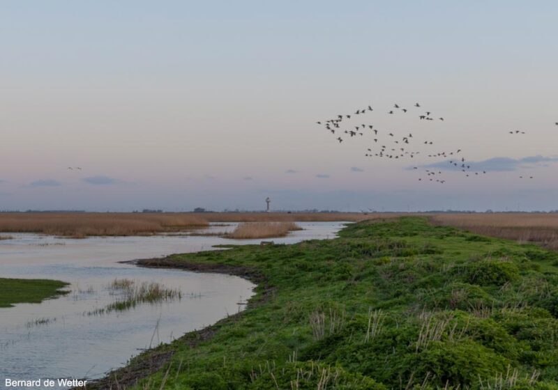
Vols d’oies au-dessus du parc naturel frontalier Groot Saeftinghe (Pays-Bas/Belgique).
Photographie : Bernard de Wetter
Introduction
L’Escaut (de Schelde en néerlandais) est un fleuve de 355 km de long qui traverse trois pays (France, Belgique et Pays-Bas), avant de se jeter en mer du Nord dans un delta commun avec la Meuse et le Rhin. Le grand port belge d’Anvers est installé dans son estuaire, ses infrastructures s’étendant sur les deux rives sur plus de 80 km de long et sur près de 129 km². Afin de profiter du développement du trafic des conteneurs, la création d’une extension de mille hectares sur sa rive gauche, appelée Saeftinghedok, avait été décidée par les autorités flamandes à la fin de années 2010 : elle tire son nom du Verdronken Land van Saeftinghe (« le Pays inondé de Saeftinghe »), une zone humide côtière située dans la province voisine néerlandaise de Zélande, qui couvre plus de 3 500 hectares : il s’agit de l’une des plus vastes étendues ouest-européennes de prés salés (ou schorres) et de vasières intertidales, un paysage qui contraste avec les cheminées de la centrale nucléaire voisine de Doel et avec les entrepôts, les grues et les pylônes du port d’Anvers, dont elle est séparée par des polders (Hedwigepolder et Prosperpolder principalement) créés au XIXe et au début du XXe siècle. Afin de compenser les travaux d’agrandissement du port et d’approfondissement de l’Escaut, le plan Sigma, un programme belge de gestion des inondations et de l’écosystème, a décidé de rendre ces derniers à la nature en ouvrant en octobre 2022 les digues qui les isolaient de l’Escaut.
Le parc naturel frontalier Groot Saeftinghe, qui comprend le Verdronken Land van Saeftinghe et les polders voisins en cours de renaturation, couvre une superficie de 4 700 hectares à cheval sur les provinces de Zélande (Pays-Bas) et de Flandre-Orientale (Belgique).
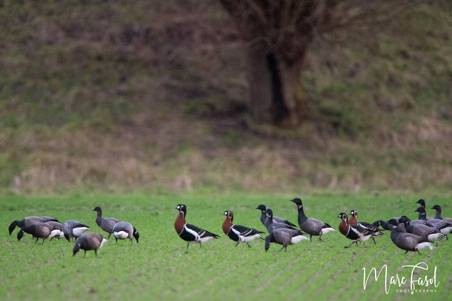
Bernard de Wetter nous propose une découverte de cette zone humide peu connue des observateurs francophones et d’un grand intérêt ornithologique, notamment entre novembre et mars.
Abstract
The Scheldt is a 355 km long river that crosses three countries (France, Belgium and the Netherlands), before flowing into the North Sea in a delta shared with the Meuse and the Rhine Rivers. The large Belgian port of Antwerp is located in its estuary, its infrastructure extending on both banks over more than 80 km long and nearly 129 km². In order to take advantage of the development of container traffic, the creation of a thousand-hectare extension on its left bank, called Saeftinghedok, was decided by the Flemish authorities at the end of the 2010s: it takes its name from the Verdronken Land van Saeftinghe (« the flooded land of Saeftinghe »), a coastal wetland located in the neighbouring Dutch province of Zeeland, which covers more than 3,500 hectares: it is one of the largest western European expanses of salt meadows and intertidal mudflats, a landscape that contrasts with the chimneys of the neighbouring Doel nuclear power plant and with the warehouses, cranes and pylons of the port of Antwerp, from which it is separated by polders (mainly the Hedwigepolder and the Prosperpolder), which were created in the 19th and early 20th centuries. In order to compensate for the port expansion and deepening of the Scheldt, the Sigma plan, a Belgian flood and ecosystem management program, decided to « return them to nature » by destroying the dikes that isolated them from the Scheldt in October 2022.
The Groot Saeftinghe border nature park, which includes the Verdronken Land van Saeftinghe and the polders currently being renatured, covers an area of 4,700 hectares spanning the provinces of Zeeland (Netherlands) and East Flanders (Belgium).
Bernard de Wetter invites us to discover this wetland, which is little known to French-speaking birders and of great ornithological interest, particularly between November and March.
Poursuivez la lecture de cet article, en vous abonnant dès maintenant !
Découvrez les Archives d’Ornithomedia.com
Pour seulement 10,00 €TTC/an (ou 6,00 € les 6 mois)
Profitez de plusieurs centaines d’articles en accès illimité et sans aucun engagement.
Compléments
Auteur
Bernard de Wetter
Dans la boutique d’Ornithomedia.com
À lire sur le web
Le site web du Grenspark Groot Saeftinghe : www.grensparkgrootsaeftinghe.eu
Ouvrage recommandé
Where to Watch Birds in Holland, Belgium & Northern France de Amoud Van Den Ber
Sources
- Kees Vliet Vlieland (2023). Grenspark Groot Saeftinghe and spoonbills. Werkgrooep Lepelaar. werkgroeplepelaar.org
- Omroep Zeeland (2023). Nieuwe wandelroutes in Groot Saeftinghe: ‘Ze moeten je zintuigen prikkelen. www.omroepzeeland.nl
- Tomas Vanheste (2022). Comment disparaît la frontière dans le Pays inondé de Saeftinghe. Les plats pays. www.les-plats-pays.com
- Nienke Brouwer et al (2022). Ecosystem design of the Delta21 area. www.delta21.nl
- Climate Adapt (2020). A transboundary depoldered area for flood protection and nature: Hedwige and Prosper Polders. climate-adapt.eea.europa.eu
- J. van Impe (1996) Long-term reproductive performance in White-fronted Geese Anser a. albifrons and Tundra Bean Geese A. fabalis rossicus wintering in Zeeland (The Netherlands), Bird Study. Volume : 43. Numéro : 3. Pages : 280-289. www.tandfonline.com
- Vista. Border Park Groot-Saeftinghe. vista.nl
- Birdingplaces. Hedwigepolder. www.birdingplaces.eu
- Birdingplaces. Prosperpolder. www.birdingplaces.eu
- Birdingplaces. Doelpolder. www.birdingplaces.eu
- Birdingplaces. Verdronken Land van Saeftinghe. www.birdingplaces.eu
Aucun commentaire sur ce sujet
Participer à la discussion !